Why I Support Proposition B
| I was not enthusiastic about Proposition B until I went through the exercise of simulating how the cityscape will likely change if Proposition B is defeated. The pictures below illustrate what I found. |
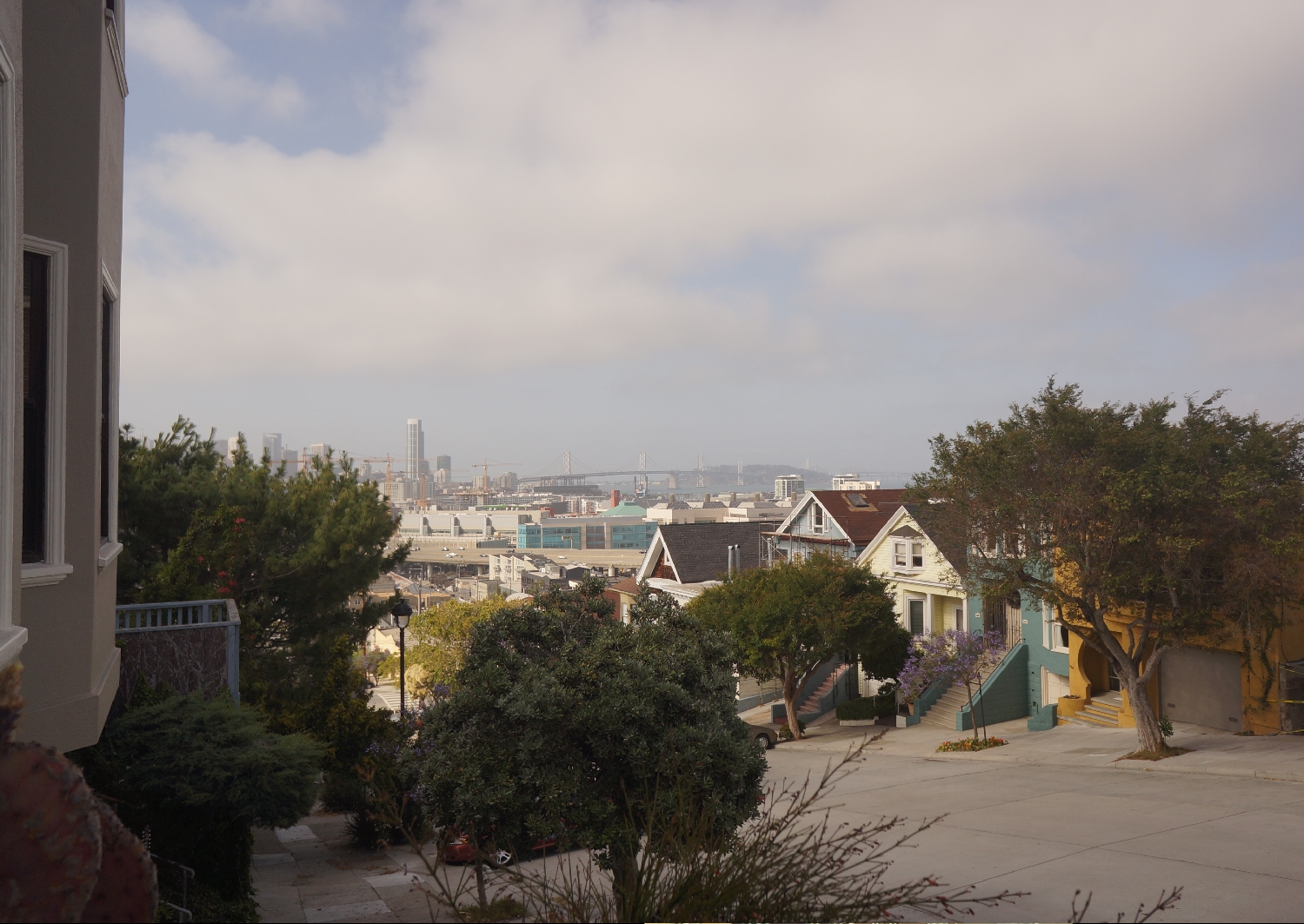
| The Today's View picture is a snapshot I took at the corner of Texas and 19th Streets, near my house on Potrero Hill. |
Today's View
| The After Construction image below is the same photo with a rendering of the 8 buildings proposed to be built on Lot A, the parking lot near AT&T Park. The construction of these buildings was approved last year by the San Francisco Board of Supervisors and the owners, the San Francisco Giants, have announced that construction may begin as early as next year. I only calculated how these building would affect our cityscape, not any additional buildings that our Board of Supervisors may green light on their own if Proposition B is defeated. |
| I also did not depict the impact of this construction from any other angles or locations since it takes time to calculate an accurate depiction and I believe this view is fairly representative of how the buildings will affect views throughout the south side of the city. The view depicted in these photos is approximately 1 mile from the 27-acre construction site. |
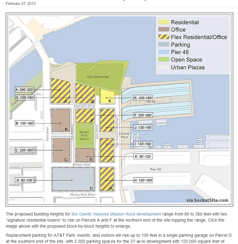
| To achieve an accurate depiction, I used GPS coordinates to mark the location of the before photo on a Google Earth map. I then overlaid the map with the most recent layout of the Lot A construction plan: |
 |
| Next,I drew sight lines on the map to mark the edges of the most southern and northern buildings in the proposed development, which defined the area (shaded on the map) which would be blocked by the buildings: |
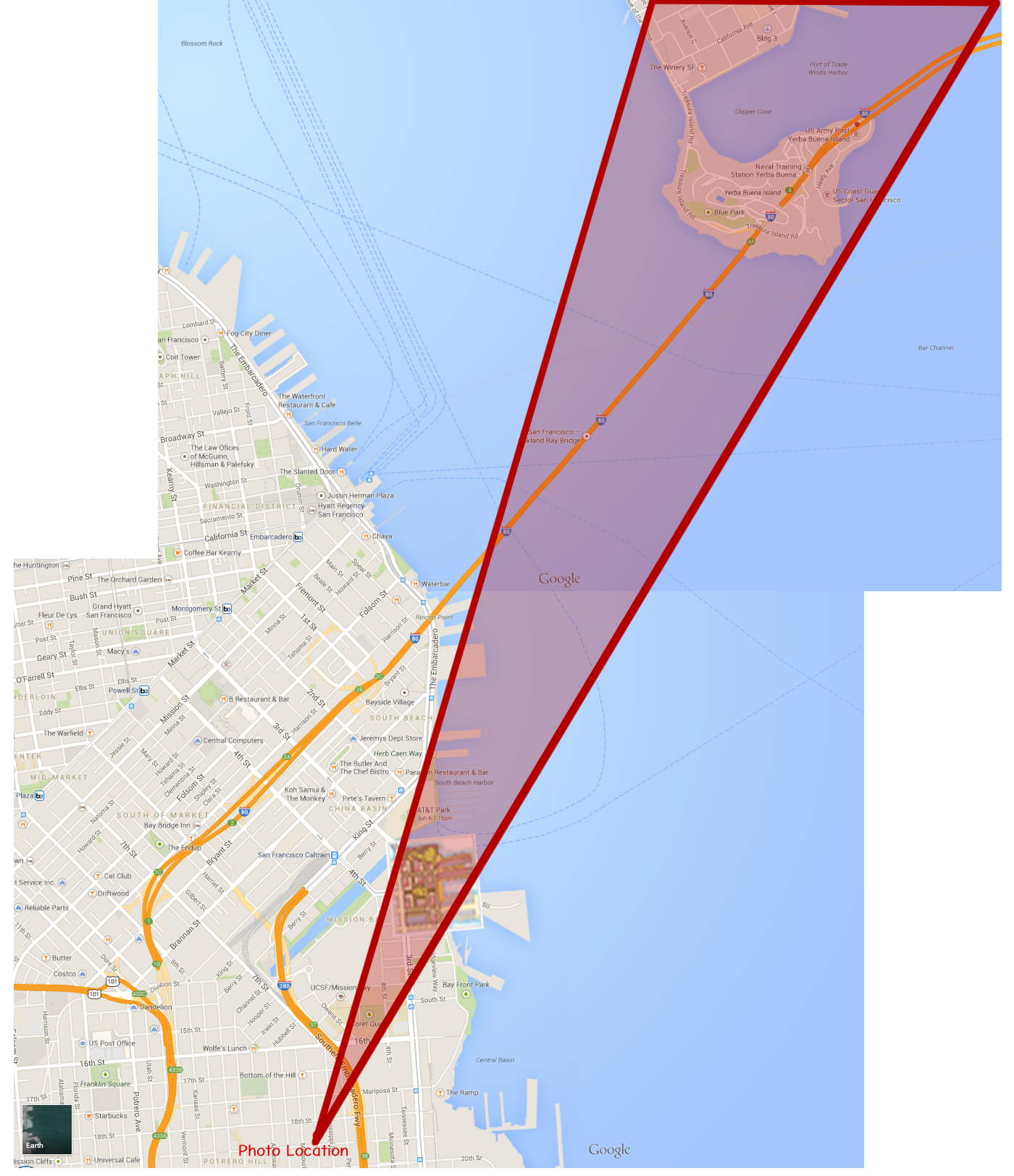 |
| Since there are no renderings yet of what the face of the buildings will look like, I adapted generic building images to construct building images that could be positioned on the map to correspond with the approved plans for the 8 new buildings. I then visited the site and noted the height of existing buildings that were nearby. |
| With this information, I was able to insert accurate, scale images of buildings into my original photo (thanks, Photoshop) that were positioned and sized to match plans for the proposed buildings on Lot A. This yielded the After Construction image below: |
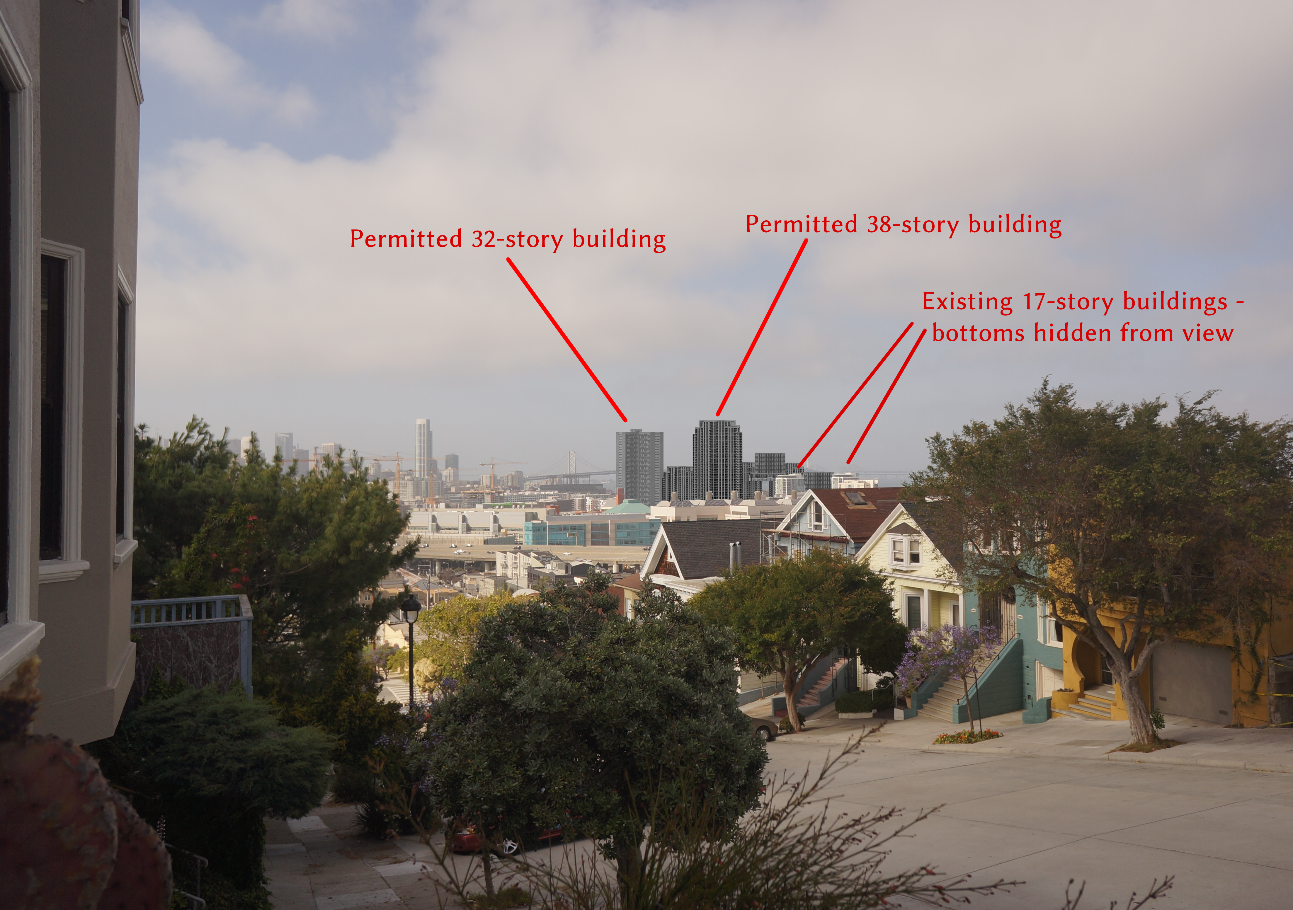
After Construction
| Any exercise like this requires various assumptions. Here are mine: |
| 1. The buildings will occupy the positions in the most recently-published plans and will be built to maximum-permitted height. Given the expense of changing plans and the economic advantages of maximizing rental space, I think both of these assumptions are valid. |
| 2. The height allowances published with the Giants plans in February 2013 are still accurate. |
| 3. My estimates of the height of existing buildings adjoining Lot A are accurate. |